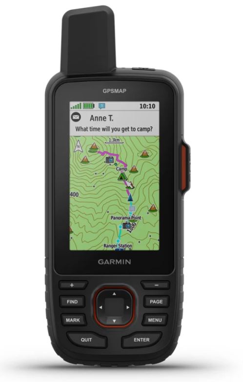
GPS DEVICE (Garmin GPSMAP 67i) geolocator SAT/GSM
Valid Article
GPS DEVICE (Garmin GPSMAP 67i) geolocator SAT/GSM
Form
Includes:
- GPSMAP 67i USB
- A to USB-C cable
- Carabiner with clip
- Documentation
General specifications:
- Lens material: chemically strengthened glass
- Dimension: 6.2 x 16.3 x 3.5 cm (2.5″ x 6.4″ x 1.4″)
- Weight: 230 g with batteries
- Water rating: IPX7
- MIL-STD-810: yes (thermal, shock, water)
- Display Type: Transflective colour TFT
- Display Size: 3.8 x 6.3 cm (1.5″W x 2.5″H ); 7.6 cm diag (3″)
- Display Resolution: 240 x 400 pixels
- Battery type: Rechargeable, internal lithium-ion
- Battery life:
- Up to 165 hours with inReach® enabled with 10 minute tracking
- Up to 180 hours in GPS Mode
- Up to 425 hours in Expedition mode with inReach enabled
- Up to 840 hours in expedition mode
- Memory/history: 16 GB (user space varies based on included mapping)
- Interface: USB-C
Fit
Maps and memory
Preloaded maps Yes (TopoActive Europe; routable on roads and trails)
Ability to add maps
Base map
Auto-routing (turn-by-turn routing)
Map segments 15,000
BirdsEye Yes (directly on device)
Includes detailed hydrographic features (coastlines, lake and river shorelines, wetlands, and seasonal and permanent waterways)
Includes searchable points of interest (parks, campgrounds, overlooks, and picnic areas)
Displays national, state, and local parks, forests, and wilderness areas
Storage and Power Yes (32GB microSD™ card max)
Waypoints 10,000
Routes 250, 200 waypoints per run
Tracks 250
Track Log 20,000 points, 250 saved gpx tracks, 300 saved fitness activities
Activities Yes
Routes 250, 250 points per route; 50 points of automatic route definition (auto routing)
Rinex connection
Sensors
GPS
Galileo
QZSS
BeiDou
IRNSS
Barometric Altimeter
Compass Yes (3-axis with tilt compensation)
High-sensitivity receiver
GPS compass (in motion)
Frequencies Multi-band
Outdoor Apps
Garmin Explore™ compatible for waypoints, tracks, routes and activities
Garmin Explore website compatible
Smart switching between Wi-Fi, cellular and satellite with Garmin Messenger app
Connections
Wireless Connectivity Yes (Wi-Fi®, Bluetooth®, ANT+®)
Function
Everyday Smart Features
Connect IQ™ (watch faces, data fields, widgets and downloadable apps)
Smart Notifications on handheld device
Weather
Dynamic Weather
Garmin Messenger App Compatible
VIRB® Remote
Garmin Connect™ Mobile Compatible
Tracking and Safety Features
LiveTrack
Tactical Features
XERO™ Positions
Ballistic Calculator Yes (unlock required)
Outdoor Recreation Features
Point-to-Point Navigation
TracBack®
Area Calculator
FISHING FORECAST
Moon/Sun Information
Geocache Mode Yes (real-time geocaching)
Custom Maps Compatible Yes (500 geocache zones) custom maps)
JPEG Viewer
LED Beacon
inReach® Features
Interactive SOS
inReach Weather
Text messages with mobile numbers and email addresses
Text messages with other inReach devices
Send and receive group messages
Exchange locations with other inReach devices
MapShare compatible with tracking
Virtual keyboard for personalized messages
Send waypoints to MapShare while riding
Send selected routes to MapShare while riding

